
- Home
- Critical Decade
- HI Climate Action
- HI Commission
- HI Resources
- HI Equity
- HI Events
Sea Level Rise Guidance Tool
Use this interactive guide to incorporate sea level rise considerations into your planning and permitting processes.
With this guide, you will be able to:
BEFORE YOU BEGIN!
- Use the interactive buttons throughout the page to help you navigate through each step of the SLR-XA Guidance Tool.
- Make sure to read each direction carefully and complete all THREE STEPS.
- You may be redirected to the Sea Level Rise Viewer Tool on a separate tab on multiple steps in this guidance tool, depending on your responses. Keep the SLR Viewer page open in a separate tab… you will need it later!
Use the property search tool in the Hawaiʻi Sea Level Rise Viewer to locate the site of interest.
To find out whether your site is exposed to increasing coastal hazards with sea level rise, you will be redirected to the State of Hawaiʻi Sea Level Rise Viewer.
NOTE: The link to the SLR-XA Viewer will redirect you to another page. DO NOT exit the SLR-XA page (you may need it later), and return here once you are done with the guidance below.
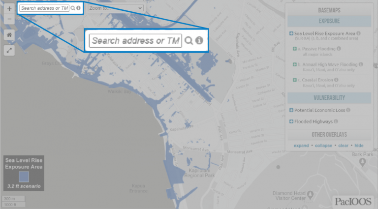
1. Enter your site address on the top-left corner of the Viewer as address number and street name is 9-digit TMK number (click the “i” on the address search tool for help).
2. Return to this page after locating the site of interest.
Is the site within the SLR-XA?
Note that the SLR-XA maps are a conservative estimate of exposure. If any part of the site is located within the SLR-XA, development could be at risk.
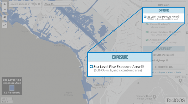
1. Explore the different SLR-XA scenarios (0.5, 1.1, 2.0, and 3.2 ft. of sea level rise) on the legend located on the right side of the Viewer (See screenshot above). Visit “Sea Level Rise Projections for Modeling” below the Viewer window for more information on these scenarios.
NOTE: State and county guidance focuses on the 3.2 ft SLR-XA as the planning scenario for most development.
2. Return to this page after exploring the different SLR-XA scenarios.
What type(s) of impact(s) is the site vulnerable to according to the SLR-XA?
Your site is determined to experience direct impacts of sea level rise. See guidance below to find out what types of impacts your site may be vulnerable to and possible actions to take.
1. Return to the Hawaiʻi Sea Level Rise Viewer (the page you were directed to in Step 1).
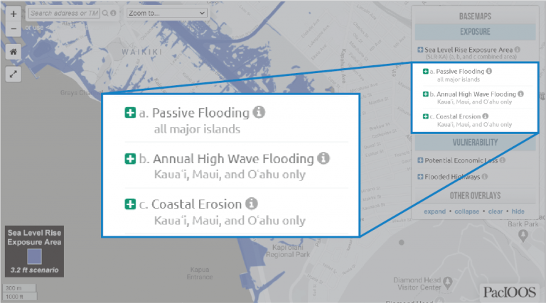
2. Explore the potential Exposure impacts (Passive Flooding, Annual high Wave Flooding, Coastal Erosion) on your site, located on the right side of the Viewer (see screenshot above).
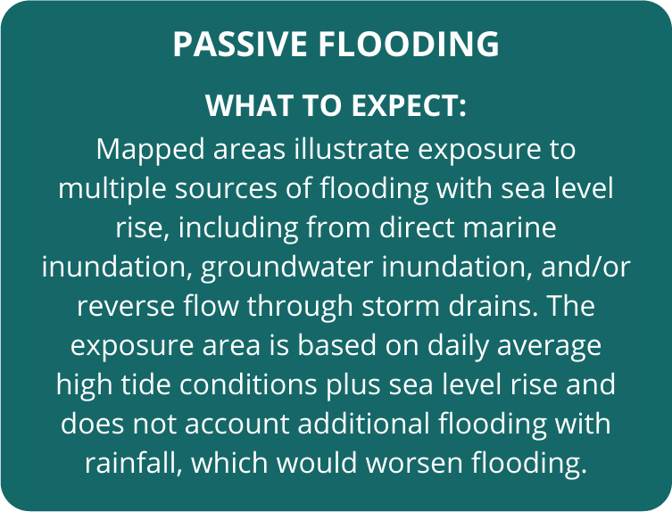
3. Return to this page after determining potential Exposure impacts on your site, and click on any of the potential impacts below to learn more on what to expect with each risk.
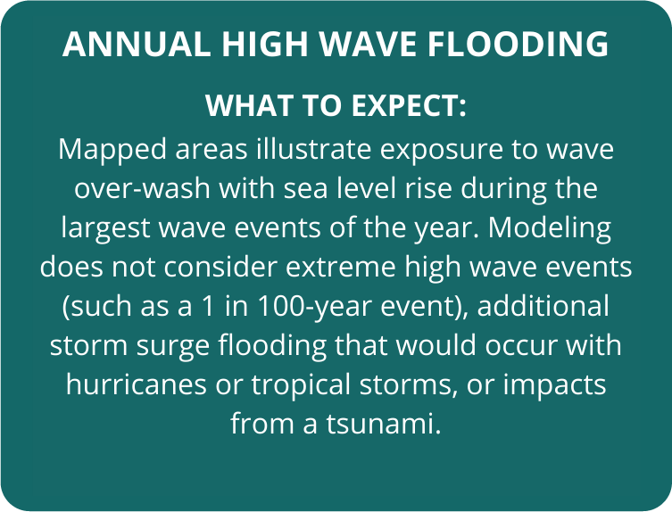
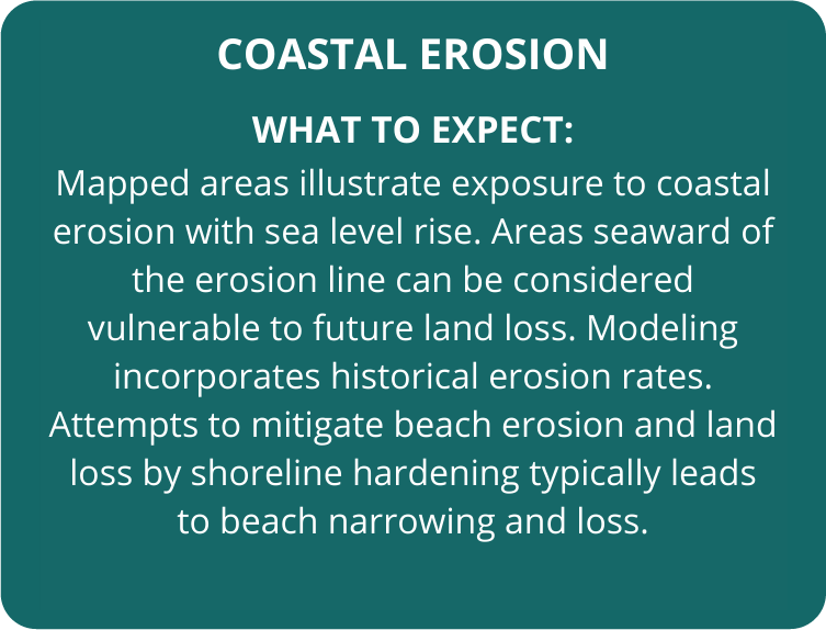
For more information, read our Sea Level Rise Guidance Report to learn more about how to utilize the Hawaiʻi Sea Level Rise Viewer and SLR-XA Viewer in your planning and permitting decisions!
Mahalo!
FOLLOW NORMAL PLANNING PROCEDURES.
Your site is not expected to be vulnerable to sea level rise impacts. Continue to plan as usual.
For more information, read our Sea Level Rise Guidance Report to learn more about how to utilize the Hawaiʻi Sea Level Rise Viewer and SLR-XA Viewer in your planning and permitting decisions!
Mahalo!